GeoWarehouse® is an invaluable tool for developers, architects, builders, engineers and other professionals in the industry. It provides a wealth of information and data that is crucial for making informed decisions and ensuring successful project outcomes. With its comprehensive range of features and user-friendly interface, GeoWarehouse streamlines the process of gathering, analyzing, and utilizing geospatial information.
Building & Developing
Select your profession to learn more:


GeoWarehouse +
Architecture
GeoWarehouse provides Architects the insight and data they need to conduct their business thoroughly and effectively. With access to the most authoritative property data in Ontario and a variety of detailed reports, Architects will not only be able to leverage this data in their daily business, but also elevate their role as a trusted advisors on any development projects.
Book A DemoGeoWarehouse +
Architecture
GeoWarehouse provides Architects the insight and data they need to conduct their business thoroughly and effectively. With access to the most authoritative property data in Ontario and a variety of detailed reports, Architects will not only be able to leverage this data in their daily business, but also elevate their role as a trusted advisors on any development projects.
How Architects Use GeoWarehouse
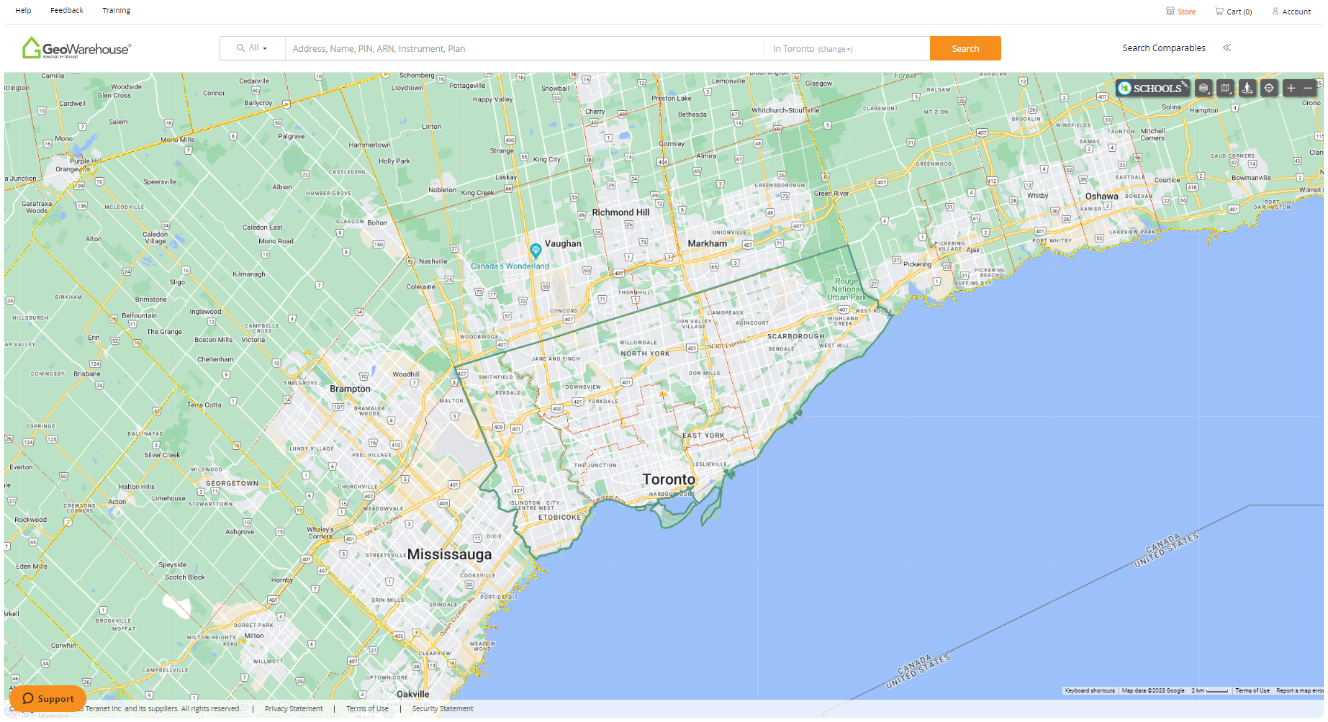
Access Property and Land Information
With the ability to pull the most authoritative property data in Ontario, GeoWarehouse allows you to be diligent in your business and provide you the insight to understand the property and surrounding location to its fullest.
Reports to Leverage
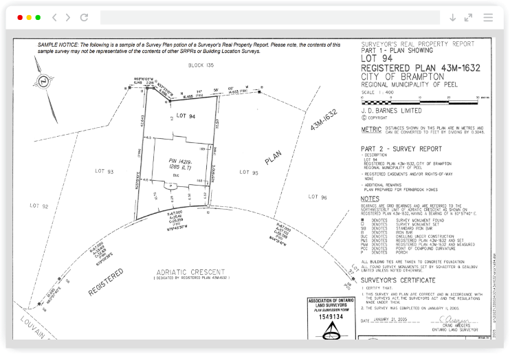
Property Survey Image
Image of the survey plan portion of a Surveyor’s Real Property Report, Building Location Survey or other undeposited plan provided by third-party surveying firms. Easily acquire dimensions of property boundary and structural elements of the land.
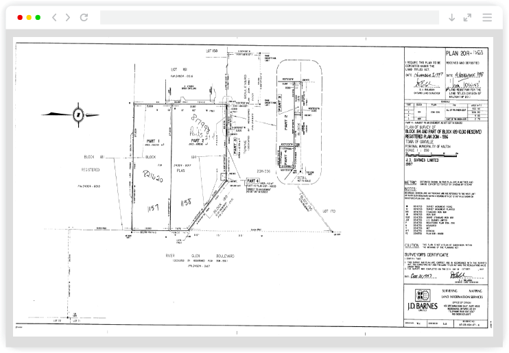
Plan Image
An image of a plan registered or deposited within the Land Registration System of Ontario may not typically include the Property Survey, but Reference Plans and Plans of Subdivision can be sourced. Quickly view a graphical representation to assist with identifying property boundaries and their location.

Aerial Imagery
Purchase high-quality aerial imagery for use in listings and other marketing materials. Access aerial imagery coverage for all Southern Ontario, including areas not currently available in many commercial mapping platforms. Receive photos at three zoom levels for marketing properties of all sizes.

Schedule Your Private Demo
See how GeoWarehouse empowers architects with authoritative Ontario property intelligence and title data in a personalized demo.
Book Now
Schedule Your Private Demo
See how GeoWarehouse empowers architects with authoritative Ontario property intelligence and title data in a personalized demo.
Harness GeoWarehouse to Complete Your Due Diligence
Apply for your GeoWarehouse subscription by completing the form.
Harness GeoWarehouse to Complete Your Due Diligence
Apply for your GeoWarehouse subscription by completing the form.
Maximize your subscription

Maximize Your Subscription
Register for an upcoming training session.
Have a Question?

Have a Question?
Contact one of our customer support representatives.
Explore the GeoWarehouse Blog


Become an Insighter
At Teranet, we are dedicated to offering you the products and solutions that are beneficial to you in your business. To ensure we are evolving alongside you and your business, we launched the Teranet Insighters Community, which offers you the opportunity to share your voice and valuable feedback.
Help shape the future of our products and services by becoming a member today.