With its comprehensive and up-to-date property information database, GeoWarehouse® revolutionizes the way professionals in these fields gather critical data and conduct investigations. GeoWarehouse provides a wealth of information, including property ownership records, historical sales data, zoning information, and more. This rich database allows law enforcement professionals to establish connections, identify patterns, and make informed decisions.
Law & Investigation
Select your profession to learn more:


GeoWarehouse +
Private Investigation
GeoWarehouse is available to Licensed Private Investigators under the Private Investigators and Security Guards Act (the “Act”) administered by the Ministry of Community Safety and Correctional Services.
GeoWarehouse +
Private Investigation
GeoWarehouse is available to Licensed Private Investigators under the Private Investigators and Security Guards Act (the “Act”) administered by the Ministry of Community Safety and Correctional Services.
How Private Investigators Use GeoWarehouse
Verify Home Ownership Information
Private investigators use GeoWarehouse to accelerate their investigations as it allows them to verify homeownership information, access sales data, use aerial imagery to view the property as well as the area surrounding the property, and more.
Reports to Leverage
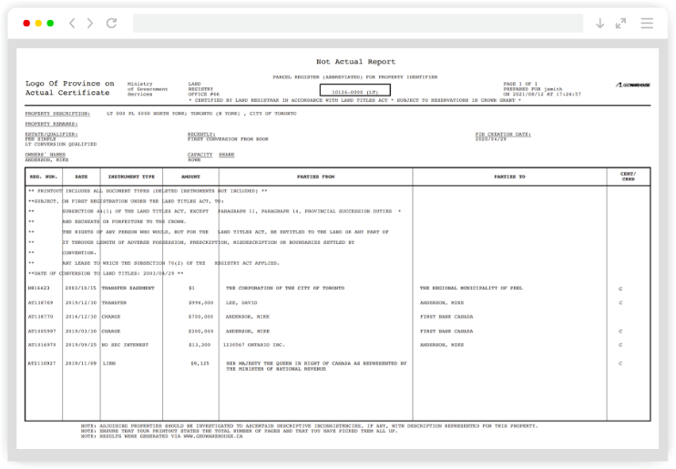
Parcel Register*
A record containing property description and list of instruments registered against the property within the Land Registration System of Ontario as of the date of search. A real-time report for a property. The provincial ownership records. Exercise due diligence by identifying registered encumbrances and acquire an instrument number.
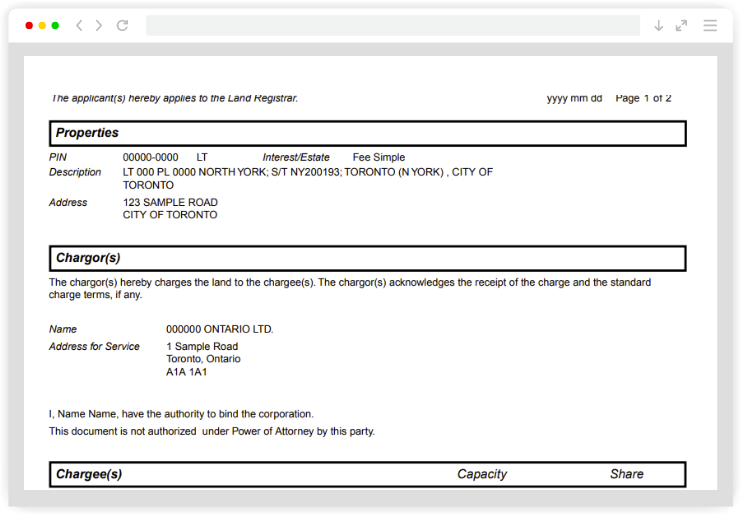
Instrument Image*
Image of a registered document within the Land Registration System of Ontario. Instruments may include liens, mortgages, transfers and condominium declarations, among others. An Instrument Number is required to purchase an Instrument Image.

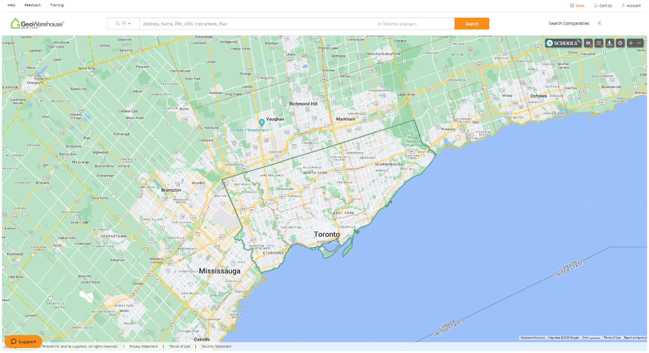
Aerial Imagery
Purchase high-quality aerial imagery for use in listings and other marketing materials. Access aerial imagery coverage for all Southern Ontario, including areas not currently available in many commercial mapping platforms. Receive photos at three zoom levels for marketing properties of all sizes.
*An official product of the Ontario government pursuant to provincial land registration statutes.

Schedule Your Private Demo
Want to see GeoWarehouse in action? Book a demo to see how you can streamline your investigations with access to government-verified ownership property data.
Book Now
Schedule Your Private Demo
Enhance your investigative processes and uncover the full potential of GeoWarehouse. We’re here to guide you through a private curated demo to showcase how our platform can be tailored to meet your specific needs. Experience firsthand how GeoWarehouse can revolutionize the investigative processes.
Harness GeoWarehouse to Complete Your Due Diligence
Apply for your GeoWarehouse subscription by completing the form.
Harness GeoWarehouse to Complete Your Due Diligence
Apply for your GeoWarehouse subscription by completing the form.
Maximize your subscription

Maximize Your Subscription
Register for an upcoming training session.
Have a Question?

Have a Question?
Contact one of our customer support representatives.
Explore the GeoWarehouse Blog


Become an Insighter
At Teranet, we are dedicated to offering you the products and solutions that are beneficial to you in your business. To ensure we are evolving alongside you and your business, we launched the Teranet Insighters Community, which offers you the opportunity to share your voice and valuable feedback.
Help shape the future of our products and services by becoming a member today.