What if the key to solving your next case isn’t hidden in a suspect’s story but in the property data they leave behind? As criminals adopt more sophisticated tactics, law enforcement professionals must outsmart—not just outwork—them.
GeoWarehouse, an industry-leading property intelligence and title data platform, provides law enforcement with access to data from the Government of Ontario’s official land registry platform, POLARIS, and pairs it with other property and real estate-related datasets. It delivers timely insights into property ownership, transaction histories, and geographic patterns, helping investigators connect the dots efficiently and accurately.
The Challenge & Opportunity
The Challenge:
Criminals today exploit complex networks, shell companies, and digital transactions to obscure their tracks. Investigators must uncover key links across vast amounts of information, which can be overwhelming without the right tools.
The Opportunity:
Property data offers a strategic advantage. By tapping into GeoWarehouse’s government-sourced land and property intelligence, law enforcement can access critical insights that help them work faster and smarter.
Three Key Benefits of Using Property Data in Investigations
- Ownership Patterns
Law enforcement can uncover who owns a property—even when ownership is concealed through layered transactions. This helps investigators connect individuals to properties that may otherwise appear unlinked. - Transaction Histories
Analyzing historical property transactions allows investigators to identify irregularities such as rapid sales, unusual price fluctuations, or suspicious financial activities—potential indicators of fraudulent behavior or money laundering. - Geographic Context
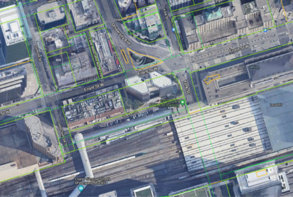
Understanding where a property is located and how it relates to known criminal activity hotspots helps law enforcement assess risks, identify patterns of criminal behavior, and plan more strategic operations in targeted areas. Additionally, aerial imagery aids in strategic deployments, such as issuing warrants or ensuring officer safety during suspect apprehensions.
GeoWarehouse consolidates essential property intelligence and title information into a centralized platform, streamlining property-related investigations across Ontario.
Data-Driven Investigations in Action
Real-world applications of data-driven insights can mean the difference between a major breakthrough and a dead end. Here are some examples of how property data helps solve cases and enhance operational efficiency:
- Detective Alex was investigating a financial (mortgage) fraud case involving hidden assets across multiple jurisdictions. Using GeoWarehouse, Alex identified properties linked to the suspect through historical ownership records. This breakthrough enabled asset recovery, secured justice for victims, and dismantled the criminal network.
- Officer Priya, assigned to a real estate fraud task force, used property transaction histories to detect a pattern of rapid sales with inflated valuations—indicating potential money laundering. Her findings exposed an organized fraud ring, preventing further financial crimes and protecting victims.
- Sergeant Mike was preparing for a high-stakes operation targeting a suspected drug trafficking hub in a suburban neighborhood. Using high-resolution aerial imagery and detailed property data, Mike and his team identified hidden structures, potential escape routes, and entry points, significantly enhancing their strategic planning.
Ready to Step Up Your Investigations?
Don’t wait to take action. Book your private group demo today to see how GeoWarehouse can transform your investigations. Already leveraging GeoWarehouse? Schedule a custom training session for your division and invite extended teams to experience its full potential.
The future of property intelligence is here—make sure your team is ahead of the curve. Training in data analysis and technology integration is just as critical as traditional investigative techniques.
Connect with us at OACP Blue Line Expo
If you’re attending the OACP & Blue Line Expo on April 29th, come see GeoWarehouse in action! Book your free demo to connect with one of our GeoWarehouse experts and discover the platform features.